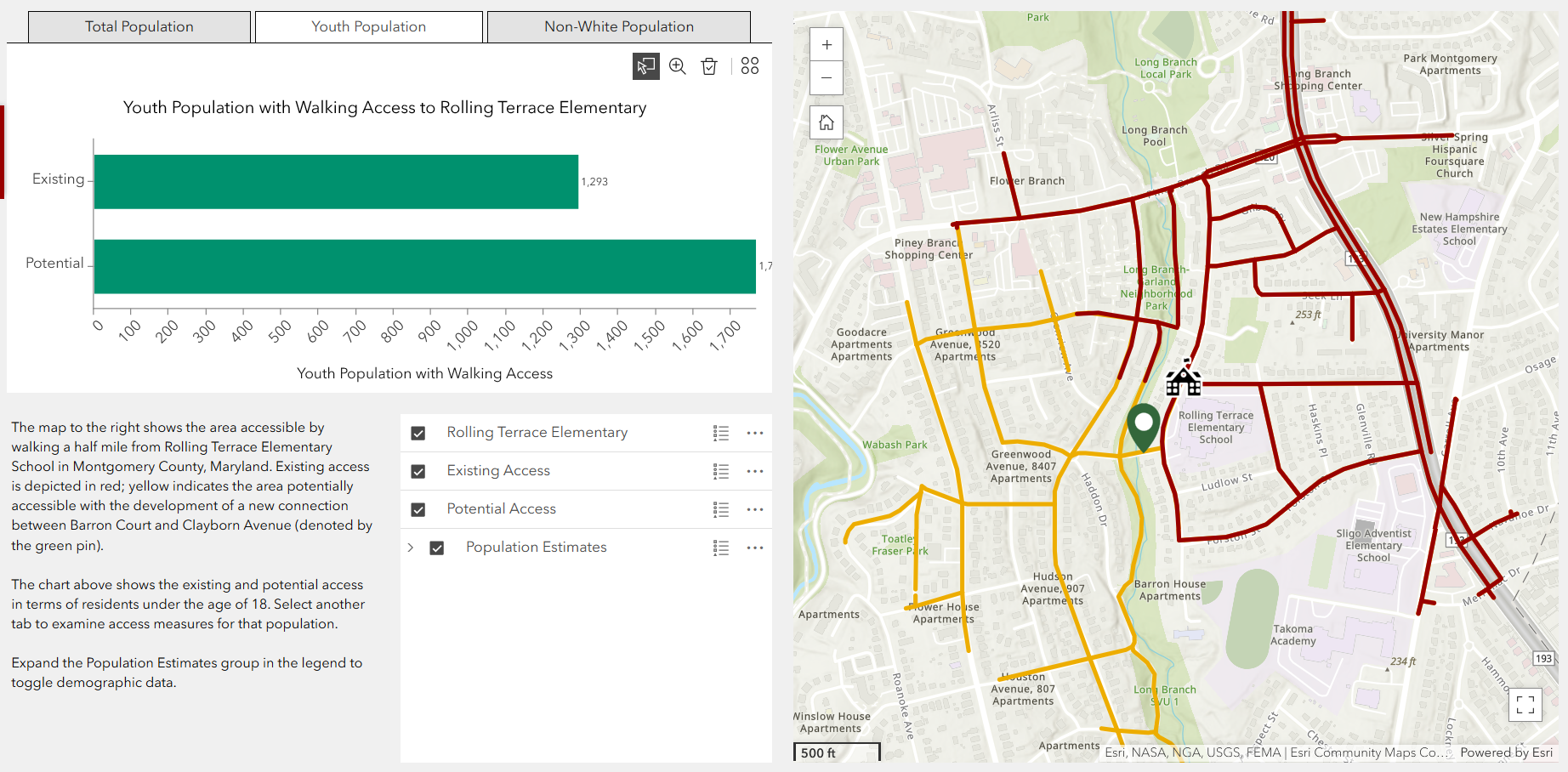
The Maryland Department of Transportation’s (MDOT) Office of Planning and Capital Programming (OPCP) is developing a statewide pedestrian infrastructure dataset within One Maryland One Centerline (OMOC), a linear referencing system for information on the state’s roadways and shared-use paths. Foursquare ITP facilitated the development of a schema to capture this data and conflate it to OMOC based on a survey of best practices and numerous stakeholder working group. Subsequently, we demonstrated the value of this work by documenting sidewalks in select areas and performing accessibility analyses to quantify changes in connectivity associated with new sidewalks.
If you’re interested in learning more about the initiative, click on the link below for more information.
Solutions and Outcomes
- Hosted four working meetings with stakeholders throughout Maryland to understand their capabilities and challenges surrounding the geospatial documentation of sidewalks.
- Developed a schema for capturing information on sidewalk presence and form throughout the state using One Maryland, One Centerline, the state’s linear referencing system.
- Conducted a demonstration of how sidewalk data can facilitate local accessibility analyses and inform planning for infrastructure improvements.
- Developed a state-of-the-practice document summarizing similar work throughout the country.