When trying to find your way around a city and its transit system, most people will refer to a one-dimensional map, which, yes, charts out the station locations, basic geography, and bus routes or transit lines. You’re able to see where you are and where you want to go and then follow the path. Google Maps, Apple Maps, CityMapper, and other similar apps are great for that.
When transit planners—like us—analyze a system, we do the same; however, what we analyze is a magical, multi-dimensional version of a map. One of which shows an entire snapshot of the transit system. It contains information and answers to questions such as:
- Where are all the bus stops, and what routes do they take?
- What are the service timings?
- How much does it cost to ride the system?
- What other transit modes, such as trains or trolleys, exist?
- Where are the accessibility options?
- Does the service run on holidays?
Presented by the National Center for Applied Transit Technology (N-CATT) and Foursquare ITP
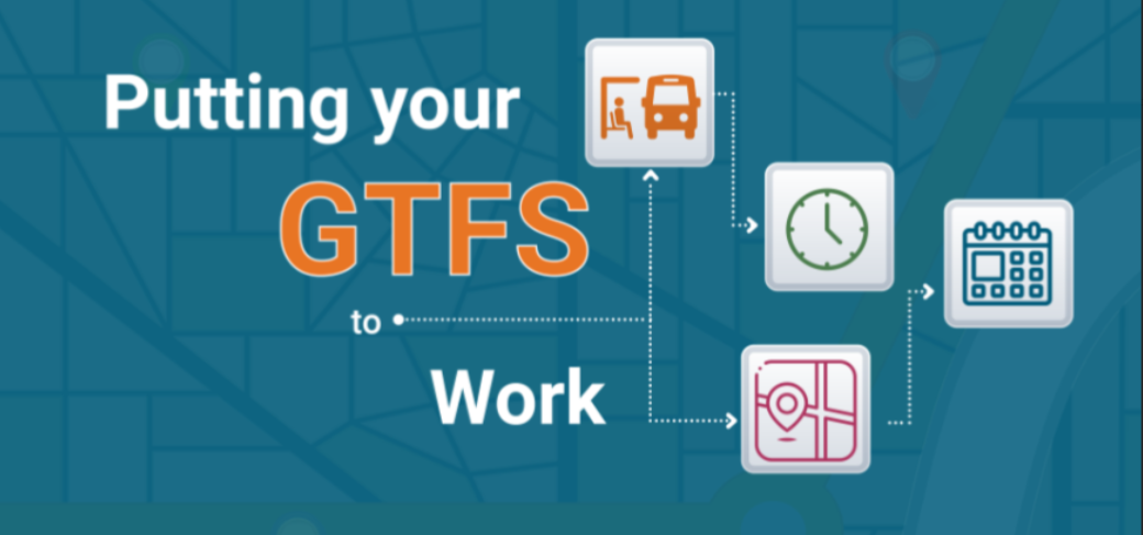
This workshop helps transit managers and planners use their GTFS Feed to its fullest potential, from reviewing the basics to explaining how it improves the rider experience.
This beginner to intermediate level course is free and worth 4 AICP CM credits and includes a mix of lecture and hands-on learning.
Every day, riders would have to consult a plethora of sources to answer these burning questions about the transit system near them. Transit planners call this the magical, single source of truth—a GTFS feed!
A GTFS feed (or general transit feed specification) is a single data entity that describes everything about a transit system. A multitude of tables and simple text files encapsulate the entirety of the system—the modes of transit, their respective routes, stops, and times, and technicalities such as fare rules, transfers, and accessibility options—that is, every minute detail of a transit system! It’s wrapped up as a single file that we can share amongst the world’s transit agencies in the same technical language or specification. It can be opened with several analysis programs and data processing options for a variety of tasks (most of which we perform at Foursquare ITP).
If you’ve ever wondered how your favorite navigation app knew when the next bus was arriving, you’ve got GTFS feeds to thank for that, especially the ‘real-time’ component. All your local transit agency must do is update the feed—which is hosted online—and everyone can download that data and use it. The emphasis lies on the data specification’s innate ability for easy sharing, production, and processing.
Here are some of our instrumental applications of GTFS feeds.
The Game-Changing Role of GTFS Data in Transit Planning
When it comes to the actual planning process, GTFS data is a game changer. This standardized format for public transportation schedules and associated geographic information is incredibly useful for mapping stops and routes, as well as conducting service frequency and headway analysis. These capabilities are crucial for spotting transit gaps and making informed decisions to improve transit services. Here’s how it works:
Visualize Transit Networks and Analyze Transit Accessibility
GTFS data provides detailed information about every stop and route in a transit network. At Foursquare ITP, our data scientists have developed a GTFS to Existing Conditions (GTFS-EC) tool that leverages this data to create maps of stops and routes for various transit services. These maps are crucial for visualizing the existing transit network, allowing planners to analyze public transportation accessibility in various neighborhoods.
By integrating GTFS data with census or employment data—which is accessible through our propensity tool—planners can evaluate whether certain areas, particularly those with vulnerable or historically marginalized populations, have sufficient access to transit services. For example, in our CATS Better Bus project, our team devised a route equity score to measure equity populations’ access to jobs along each route. Equity populations, in this case, mean low-income riders, minority groups, and those without access to a personal vehicle. Additionally, the CATS route access score analysis also includes the accessibility of light rail stations and other points of interest, such as grocery stores and hospitals. These kinds of spatial analyses can help agencies understand the way transit service connects people to certain kinds of work and non-work economic activities, whether that access is distributed fairly among different populations, and how changes to transit service enable or hinder those populations’ access to opportunity.
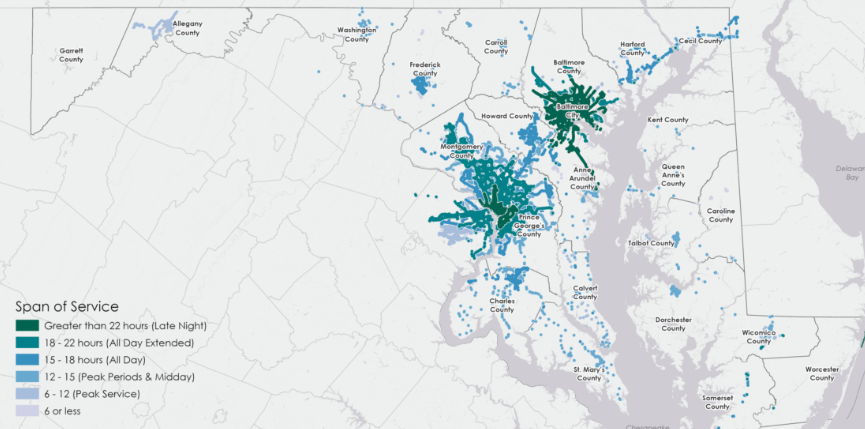
Calculate the Level of Service and Identify Transit Gaps
Transit gaps are regions where the demand for public transportation surpasses the existing service provided. Our team has developed many comprehensive gap analysis frameworks that compare the frequency of existing transit networks in each region to transit propensity. Using our powerful GTFS-EC package, we can seamlessly convert the collection of .txt files from GTFS feeds into detailed trip and stop level schedule information, enabling an in-depth analysis of service levels.
In addition to GTFS feeds, we use transit propensity data from our propensity model, which classifies geographic areas based on the likelihood of available transit services being used. Our advanced tools and data enhance service planning and effectively address transit gaps.
Create and Modify Feeds
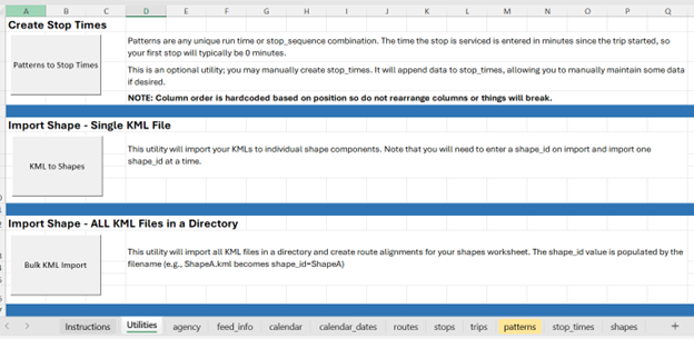
Not only do we use existing feeds for analysis, but we also create and modify new ones! Our spreadsheet tool helps small and rural agencies create, modify, and maintain GTFS feeds in Microsoft Excel. This tool allows agencies to easily import feeds, update schedules, and export feeds in the GTFS standard format with just one click. Using these feeds, agencies can perform more complex analyses, including accessibility modeling, ridership estimates, and other scenario analyses.
In today’s fast-paced world, data-driven approaches are crucial for effective transportation planning. GTFS data, along with advanced tools and models, empowers transit agencies to visualize networks, assess accessibility, and identify service gaps. These insights enable planners to make informed decisions that promote equity and enhance transit service efficiency.
At Foursquare ITP, we are dedicated to utilizing innovative data and technology to transform transit planning and create more accessible, equitable, and efficient transportation systems for all communities.
So, the next time you open your app for directions or find out when the next bus is set to arrive, you can celebrate the importance of GTFS in your daily life, just like we do.